Monday, 18 July 2016

Manifold Valley, Evening Rab Mini Marathon


Having done my first of these in Dovedale earlier in the year, I was fortunate enough to be able to team up with our Joel for this event around the Manifold valley.  The rain, as forecast, had moved away by the time we arrived, some time after six, to a well organised registration and a friendly relaxed atmosphere.

We took the opportunity to unload any kit we didn't need and had a little study of the map on the board (without the check points) just to give us an idea of what to expect.  Initial thinking was that we would be making our way down the Manifold track to start with but once we had taken our starters orders and checkpoint map it looked like the Wolfscote Dale side might be a bit more rewarding a decision which in hindsight was a good one.

After a bit of a road start and ticking off the first marker we headed off to number sixteen, a decision which in hindsight was not a great one.  At first it was boggy, then extremely boggy and then steep with the dibber station on top.  And then we came back down pretty much the same way as we went up.  Looking back later we could see we could have picked this one up later without so much climb involved.

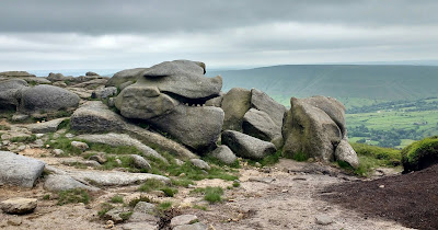
Great views though...
 
Once off the hill we worked our way around to Wolfscote Dale itself, picking up another check point before running down this very pretty valley towards points thirteen and twelve.  The close proximity of these two suggested interesting times and sure enough they had been placed about as high above either side of the valley as they could have been with a river crossing to make between them.

After that had all been completed we ignored another check point and made our way over to the other side of the map already eating into our second hour.

Having aimed first for number four up the climb next to Wetton Hill we then took time to assess what we could achieve in with the rest of the time, pausing as well to appreciate the terrific 360 degree views we had.
We reckoned on three more dibs on the way back could be done and we set off down the tussocky slopes, appreciating the fact that we weren't trying to climb up this way.
Picked up the first two of the three we arrived at a t-junction.  Eight minutes of the two hours remaining, the finish to the right and a 10 point checkpoint to the left Joel persuades me that, for the banter, the extra points is the way to go.  As we only arrive back late back at the finish by under 4 minutes this gives a net gain of six points for the effort..

A great selection of cakes greets us at the end, rhubarb, lemon drizzle, raspberry meringue, flapjack and a fabulous gooseberry sponge. The results are also in and we can see that we are in the top ten by three points.  Great call Joel!

Thoroughly recommend these events,  really enjoy the additional challenge of the navigation and the extra freedom of route choice and being able to stop every now and then without the feeling of losing places that you would have in a straight race.  Looking forward to the next one.

Endomondo route is here

Results  make a great read post event as you can see all the different routes people took and how they got on.

Monday, 4 July 2016

Kedleston Hall

Apart from the odd drive through, I've not spent much time at Kedleston Hall, probably in the main because they like to charge £5 once you get out of the car so the whole of the estate falls under the entry fee. But with the family National Trust membership that was given us this year in place and Kedleston being our nearest major NT property we are trying to make the most of it.


If you take in all the trails then you can probably get a six and a half mile route out of the estate but Sunday's run just took in the long walk and the lakeside walk.  Once away from the house area it was pretty quiet even for a Sunday and there's plenty to look at on the way round.  The long walk has a gentle climb before levelling out all on a tree lined path, nice and shady in the summer, with some great views of the house before dropping down towards the lakes. Don't miss the path down to the splash pool.
Route on Endomondo

Didn't see any otters otters or kingfishers this time but plenty of cows, sheep, geese, coots and even some oyster catchers, can't believe there's any oysters to be caught there though.  Next time definitely take in the wilderness walk and take it out into the surrounding countryside as well.  Really lovely place for a picnic as well.
I understand that the jog club go there or did go there once a month which sounds like a great idea.


Saturday, 2 July 2016

Hope Wakes Fell Race 2016

Having been told this was a 'not to be missed' event I was pretty gutted that work had organised an upgrade for me on the evening of this race, but as 5:15 approached I had news that the project had been postponed and my evening was sorted.  Managed to finish what I was doing by twenty past six and as I was in Chesterfield had plenty of time to get across to Hope with 20 minutes to spare.
 
View from the start with the top of Win Hill just peeping out above the farmhouse.
Although it had been raining most of the day the forecast and indeed the weather for the evening was fine, bit of threatening cloud but also some occasional sun.  Six other Belper Harriers who had made the trip were already signed in and warming up amongst the other runners and puddles. No problems with parking and registration was very well organised and quick leaving enough time for warm up and a crucial reccie of the finish.

Quite a bit of tarmac at the start which I'm not a big fan of but the pack was nicely thinned by the time we got onto the fields.
After that its a clockwise run round round with two significant climbs and a fast finish back to the sports ground.

Had finally managed to get some fell shoes which certainly helped through some of the muddier sections especially in the woods where the wet weather had certainly taken its toll and I really warmed to them on the descent where they proved to be very stable.

First incline passed by without too much event before what proved to be quite a long passage through the forest with glimpses of Ladybower reservoir on the left.

Would have been nice to have stopped to take in the view here and on the way up Win Hill, but a quick glance round as we made our way through the heather prompted me to take out the phone.  The going was hard but slow so no time lost in taking a quick photo.  The reward for the hard work in getting to the top was instantaneous with a fantastic view across a sunlit Hope valley.
Route on Endomondo
After that it was all down hill to the finish and unlike my previous outing at Edale, I managed to hold on to my position and even work my way past a few people once we got to the open fields.  Managed to spot the finish before the last couple of stiles and chose to jump the mini ford instead of crossing the wooden bridge.  Having been across it earlier I knew new trainers were nearer to ice skates on the wet wood.

Loved the evening and really enjoyed the route,  would be great for a walk or run.  Hope to be back next year.  Credit to the organisers, marshals and helpers, quick registration and the first set of results seemed to be going up as I finished.  


Tuesday, 21 June 2016

Kinder from Upper Booth


Inspired by a recent visit to Edale for the Fell race I returned for a Father's day walk up to Kinder Downfall and back round via Grindslow Knoll.


We parked in the parking area on the road to Upper Booth ("You are here" on the map) and then continued up the road on foot to pick up the Pennine way.   There's more spaces in Edale itself with toilets, cafe and pubs but this suited us nicely and we called in on Edale after we had finished.

Once on the Pennine way we pretty much followed a route as shown on the map up to Kinder Downfall back across the Peat bogs to Crowden Tower before heading across to Grindlow Knoll and back down.  Just over 8 miles in total.
Route on Endomondo
The picture on the left shows the valley up which the pennine way travels before arriving at Jacob's ladder.  There's quite a number of ways to get up onto Kinder but judging by the number of people coming up and down, this must be one of the more popular.

Bottom of Jacob's Ladder


Its then quite a steep but steady climb all the way to the top but the effort is rewarded whenever a pause is made to turn around and take in the expanding views.

Once at the top we have then continued straight on up the Pennine way to Kinder downfall before turning right to follow the river into and across the peat.  This gives us two very different aspects of Kinder.  On the way out we are amongst the rocks and boulders and have fantastic views to the left down to Kinder reservoir, and on the way back we are in the gulleys, finding Christmas trees and  hopping across the tufts with only one of us temporarily losing a leg to the marsh. 

After reaching Crowden Tower instead of taking one of the routes straight down we've turned left and headed off to take in Grindlow Knoll which was well worth it if only to have a look at the route taken by the fell race the previous week.  From there it was across the plateau on a grassy path before a steep descent back onto the Pennine Way.  Lovely days walking and lots of route choices so its easy to be flexible when you are up there.  And, the rain started just as we were walking down the lane back to the car, perfect.


Approaching Crowden Tower

Views from the top of Kinder Downfall


Saturday, 18 June 2016


Living in Derbyshire gives me access to some fantastic countryside great for walking and running, alone, with the dog or with family,  Am hoping to get a blog going of places I get to which may be of interest.

Today is easy, a run round Carsington with our border collie.  I prefer to park at the Sheepwash and run in a clockwise direction getting the worst bit, which runs by the road, out of the way first.  Eight miles round its a good place for a morning run with plenty of views across the water.

I think the Sheepwash car park opens at 9am but just a short way down the road opposite is a little layby which is just as good, and free. I was there just after eight this morning and it was nice an quiet.  A few cyclists, couple of joggers and some walkers.


View from the northern end of the reservoir (bottom left on the map above).
Plenty of undulation on the opposite side to the visitors centre, before arriving at the Millfields car park.   Its then flattish all the way back, over the dam, past the visitors centre and back to Sheepwash.


View across to hills behind Carsington and Hopton


My favourite view of the reservoir  can be found on the hills above Carsington village.  I'll get a picture next time I get round the Wirksworth undulator route.


Not actually much access to the reservoir or to the streams that feed it so any old puddle is a welcome stopping point.